 The
Cedar Falls Overlook is a vantage point high above 95-foot Cedar
Falls, one of the most photographed waterfalls in Arkansas. A
barrier-free walkway with wayside exhibits leads down to this
overlook.
The
Cedar Falls Overlook is a vantage point high above 95-foot Cedar
Falls, one of the most photographed waterfalls in Arkansas. A
barrier-free walkway with wayside exhibits leads down to this
overlook.Arkansas
Campgrounds
te Park :
1285 Petit Jean Mountain Road
Morrilton, AR 72110
GPS: 35.11707398671, -92.93882131576
Petit Jean State Park is a 3,471-acre park in Conway County, Arkansas managed by the Arkansas Department of Parks and Tourism. It is located atop Petit Jean Mountain adjacent to the Arkansas River in the area between the Ouachita Mountains and Ozark Plateaus. Phone: (501) 727-5441
Petit Jean State
Park is an Arkansas classic, a natural and historic treasure that has
welcomed travelers for decades. The natural beauty and ancient
geology of the legendary Petit Jean Mountain inspired the creation of
Arkansas’s first state park and with it our state park
system. The park mirrors the mountain’s rugged beauty with
its rustic-style, native log and stone facilities constructed by the
Civilian Conservation Corps (CCC) beginning in 1933. The CCC built
trails, roads, bridges, cabins, and the focal point of the park,
historic Mather Lodge, a 24-room lodge overlooking Cedar Creek Canyon
with a restaurant, meeting rooms, and gift shop. The fireplace in the
lobby serves as a welcoming gathering place in the winter.
Near
the lodge are 33 cabins (21 with kitchens) located along the bluff
with views of the canyon. Another cabin with a kitchen is a short
drive away. Most of the cabins are the rustic CCC-style with modern
amenities, and a few are duplex designs. Upstream from Cedar
Creek, a CCC rock dam forms Lake Bailey, 100 acres for fishing,
kayaking, and pedal boating. Open in the summer months, the boathouse
offers a snack bar, boat rentals, and supplies. The 125 park
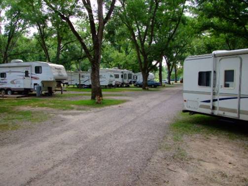
campsites (35 Class AAA and 90 Class B) are near Lake Bailey.
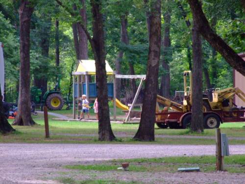
Two
swimming pools, picnic areas, playgrounds, pavilions, boat launch
ramp, tennis and basketball courts, and an amphitheater are also on
site. Hiking trails lead through forests and meadows, over canyons,
and along streams and the mountainside. See where nature formed sheer
bluffs, the spectacular 95-foot Cedar Falls, Seven Hollows, and such
distinctive features as Bear Cave, the Grotto, Natural Bridge, and
other formations like carpet rocks and turtle rocks. Interpreters
lead programs and special events throughout the year showcasing the
uniqueness of this park. Rarely do you find a place that will beckon
you back again and again. Petit Jean is that place.
Trail Type: Day Hikes
Difficulty: Moderate
Distance: 4 1/2 miles
Time: 4 hours hiking time Hiking times may vary.
This loop trail passes through a series of small canyons under the canopy of a dense hardwood forest. Unique features such as a natural stone arch, rock shelters, a box canyon and signs of prehistoric bluff-dwelling Native Americans add to the experience of this truly spectacular trail. (Light Blue Blazes).
Trail Type: Day Hikes
Difficulty: Moderate, Strenuous
Distance: 2 miles round trip
Time: 1 1/2 - 2 hours hiking time Hiking times mary vary.
The trail begins behind the breezeway at Mather Lodge, a majestic CCC rustic style mountain lodge, and winds down into Cedar Creek Canyon. Massive stone boulders and large trees adorn the trailside. The trail then follows Cedar Creek to 95-foot Cedar Falls, one of the tallest continuously flowing waterfalls in the state. This is a photographer's paradise. (Orange Blazes)
Get information on the more than 20 miles of hiking trails in Arkansas that will lead you through Petit Jean's natural and historic resources. Walk to the spectacular 95 foot Cedar Falls, one of the most spectacular waterfalls in Arkansas, meander through ancient geology on the Seven Hollows Trail, or enter Rock House Cave and view ancient pictographs.
Overlooks:
Rising 1,120 feet above the Arkansas River Valley, Petit Jean Mountain offers sweeping views and many overlooks from which to enjoy them.
Petit Jean's Gravesite at Stout's Point on the mountain's East Brow is Petit Jean State Park's most well-known overlook. This is a peaceful place to enjoy the breathtaking view of the Arkansas River below and learn about the romantic legend of Petit Jean. An elevated, barrier-free walkway including wayside exhibits affords views from different points around Stout's Point. Legend tells of the young French girl who disguised herself as a cabin boy so she could secretly accompany her fiancé to the "New World". Petit Jean became fatally ill and requested to be buried here. From this point, you can view the Arkansas River, Lock and Dam #9, Blue Point, and Ada Valley.
The Mary Ann Richter Overlook on Red Bluff Drive offers views toward other mountains including nearby 1,350-foot Mount Nebo and distant Mount Magazine, Arkansas's high point at 2,753 feet. Dardanelle Rock, Carden Bottoms and Holla Bend National Wildlife Refuge are also visible from this overlook.
Further down Red Bluff Drive, the CCC Overlook is on the bluff of Cedar Creek Canyon. Built in the 1930s by the Civilian Conservation Corps, this native stone overlook offers views of the Canyon and the Petit Jean River.
At the Palisades Overlook on Ark. 154, you can look down into Cedar Creek Canyon or across to the CCC Overlook on the opposite rim. This overlook is an excellent viewpoint for watching the sunset over the Arkansas River Valley.
The
Cedar Falls Overlook is a vantage point high above 95-foot Cedar
Falls, one of the most photographed waterfalls in Arkansas. A
barrier-free walkway with wayside exhibits leads down to this
overlook.
Buffalo River Area
NEW: Campground - on the Little Buffalo River
![]()
![]()
![]()
![]() Enjoy
a thrilling and unique experience outdoors in the heart of the
Ozark
Enjoy
a thrilling and unique experience outdoors in the heart of the
Ozark![]() wilderness of Arkansas, USA. Your hosts, Julie and
wilderness of Arkansas, USA. Your hosts, Julie and![]() Richard Milner, offer private, peaceful campsites for
Richard Milner, offer private, peaceful campsites for![]() your very own special vacation in beautiful natural
your very own special vacation in beautiful natural![]() surroundings.
surroundings.
Southwest of Jasper, Arkansas off Highway 74
http://www.snyderweb.com/yanasochee/index.html
near Hardy Arkansas
……………………………………………………………
Cossatot River State Park/Natural Area
http://theadamssfamily.com/CG/AR/Coss/Coss.htm
I-40 Area
Van Buren Area, Exit 3
Park Ridge Campground
479-410-4678 1-866-268-8103
North ¼ mile on Lee Creek Road and turn right on Rena Road. Small sign at the turn and the CG is about ¼ mile on left. Great for a 1 night stop, or to stay a few days to see the area.
New owners were very nice and escorted our two rigs to our sites and made sure the 5th wheel made it into a site clear of low tree limbs. True 60-65 foot pull throughs. (review by John Adams, on premises 7/23/07.)
 Ed’s
Ed’s
 Our
Rig. 53 feet long in total.
Our
Rig. 53 feet long in total.
Ouachita National Forest
Map listing 38 campgrounds
http://www.fs.fed.us/oonf/rec/recmap.htm
Looking
for electric and water hookups?
Cedar
Lake
Charlton
Lake
Sylvia
Little
Pines